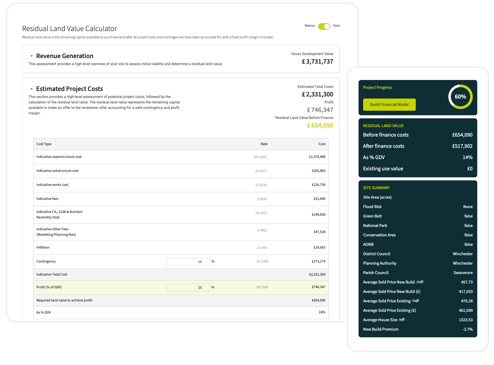
Optimise design efficiency with accurate site assessments
Streamline your workflow by quickly generating precise site massing layouts and initial appraisals, minimising your effort while maximising value. Help developers make informed, data-driven decisions with confidence, enabling more profitable investments and reducing risk. Focus your expertise on what matters most, and deliver results that set you apart in a competitive market.
No credit card needed
Key features for architects and consultants
Unlimited and Instant Residual Land Value Assessments
Learn moreViability allows you to instantly assess the residual land value of any site using indexed sold property data and accurate build cost information. Additionally, our comprehensive land value data layers integrated into our mapping tool help you identify the most promising locations for development across the UK.
Site Constraints and Optimisation
Learn MoreViability creates constraints plans at the click of a button to understand the true developable area of your site. We’ve combined Ordnance Survey Building Data with the latest policy regulations to automate the; assessment of overlooking distances, analysis of underground and overhead constraints and evaluation of trees and protected areas.
3D Site layout tool
Learn MoreViability gives you the tools to generate 3D site layouts and run massing exercises to assess site densities and optimise scheme designs. Our tool allows you to add any preformed house type to the map and adjust its position, rotation, height and width.
“With Viability, I was able to run a full viability analysis for a site I was familiar with in minutes. It would have taken me at least a day or two and was happy to find the results were really accurate”
“With Viability, I was able to run a full viability analysis for a site I was familiar with in minutes. It would have taken me at least a day or two and was happy to find the results were really accurate”
Oli Watkins, Beaufort Homes
Data Partners


Accurate Data


